Pathfinding and routing in Lanelet2
Poggenhans & Janosovits, IEEE ITSC 2020: Lanelet2 builds the routing graph at runtime rather than storing it, so the same map can be queried for the ego vehicle, other road users, and changing traffic rules.
HD maps for autonomous driving
Lanelet2 is the HD-map library for autonomous driving: a consistent map model, routing, traffic rules, and Python bindings — built to be extended. Teams use it in all components of autonomous driving stacks, robotics, dataset pipelines, and research. It enables real-world autonomous driving with open-source stacks such as Autoware, and offline research by supervising HD map construction models and end-to-end models. HD maps furthermore enable all kinds of simulation environments and provide strong priors and an evaluation basis for novel view synthesis and generative closed-loop simulation.
Originated at FZI Research Center for Information Technology
with ongoing work at KIT-MRT and the Lanelet2 community
The Lanelet2 library, documentation, Python package, and first-party papers — start here.
The C++ library with Python bindings, ROS/ROS2, Docker, and Conan. BSD-3 licensed.
Open repository ↗Primitives, architecture, geometry, projections, and map tagging — the official docs site.
Read the docs ↗Install the Python bindings with pip: pip install lanelet2.
View on PyPI ↗Poggenhans et al., IEEE ITSC 2018: the original HD-map framework paper — consistent primitives, routing, and an extensible model for autonomous driving.
PDF ↗Poggenhans & Janosovits, IEEE ITSC 2020: Lanelet2 builds the routing graph at runtime rather than storing it, so the same map can be queried for the ego vehicle, other road users, and changing traffic rules.
First-party tools from the Lanelet2 maintainers for mapping, editing, and workflows.
© KIT-MRT
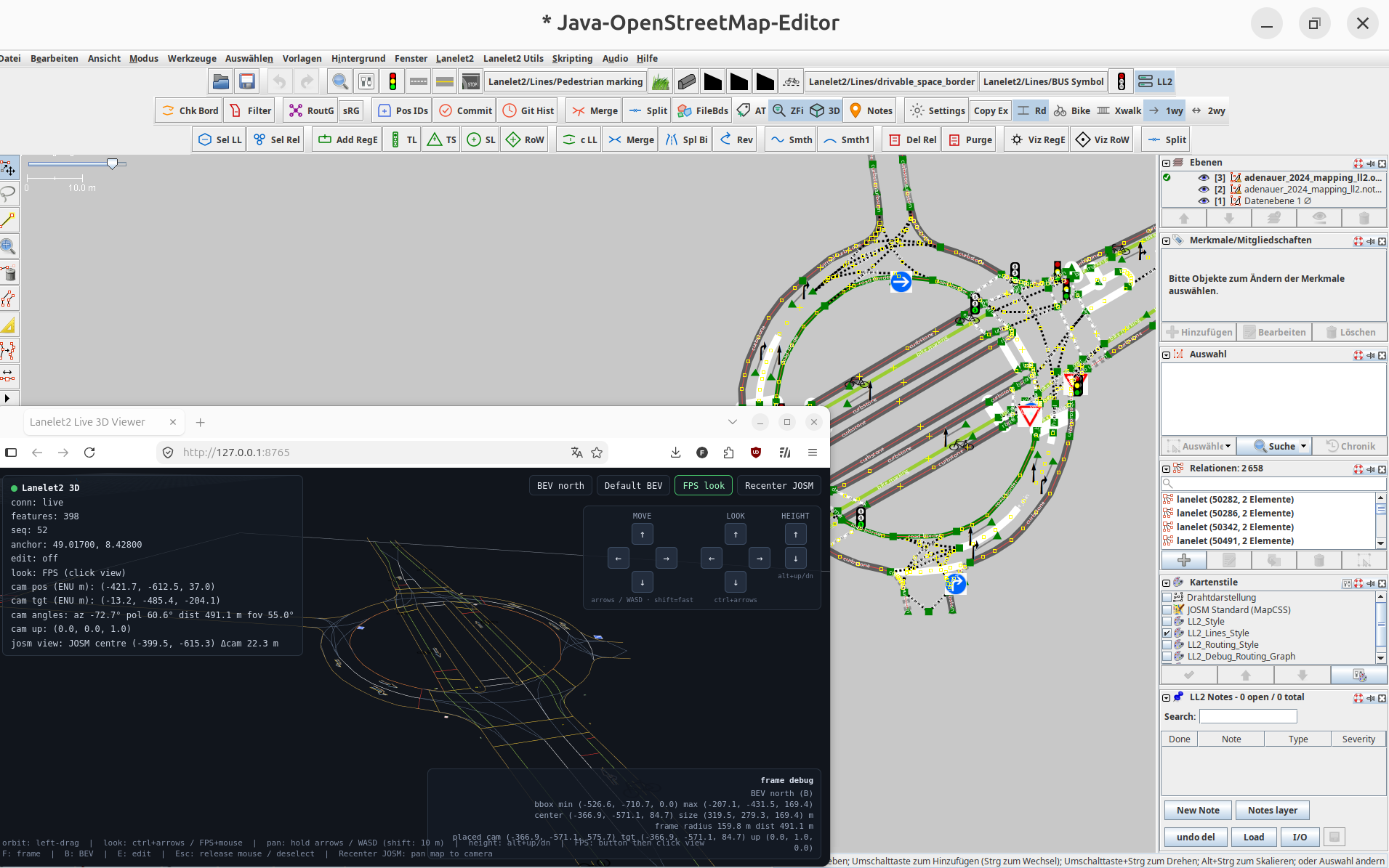
Native Kotlin plugin for editing Lanelet2 maps in JOSM — lanelets, regulatory elements, routing debug, and a live 3D viewer.
Companion JOSM plugin that runs Python 3 (GraalPy) against map objects — including numpy — without packing the engine into the plugin JAR.
GitHub ↗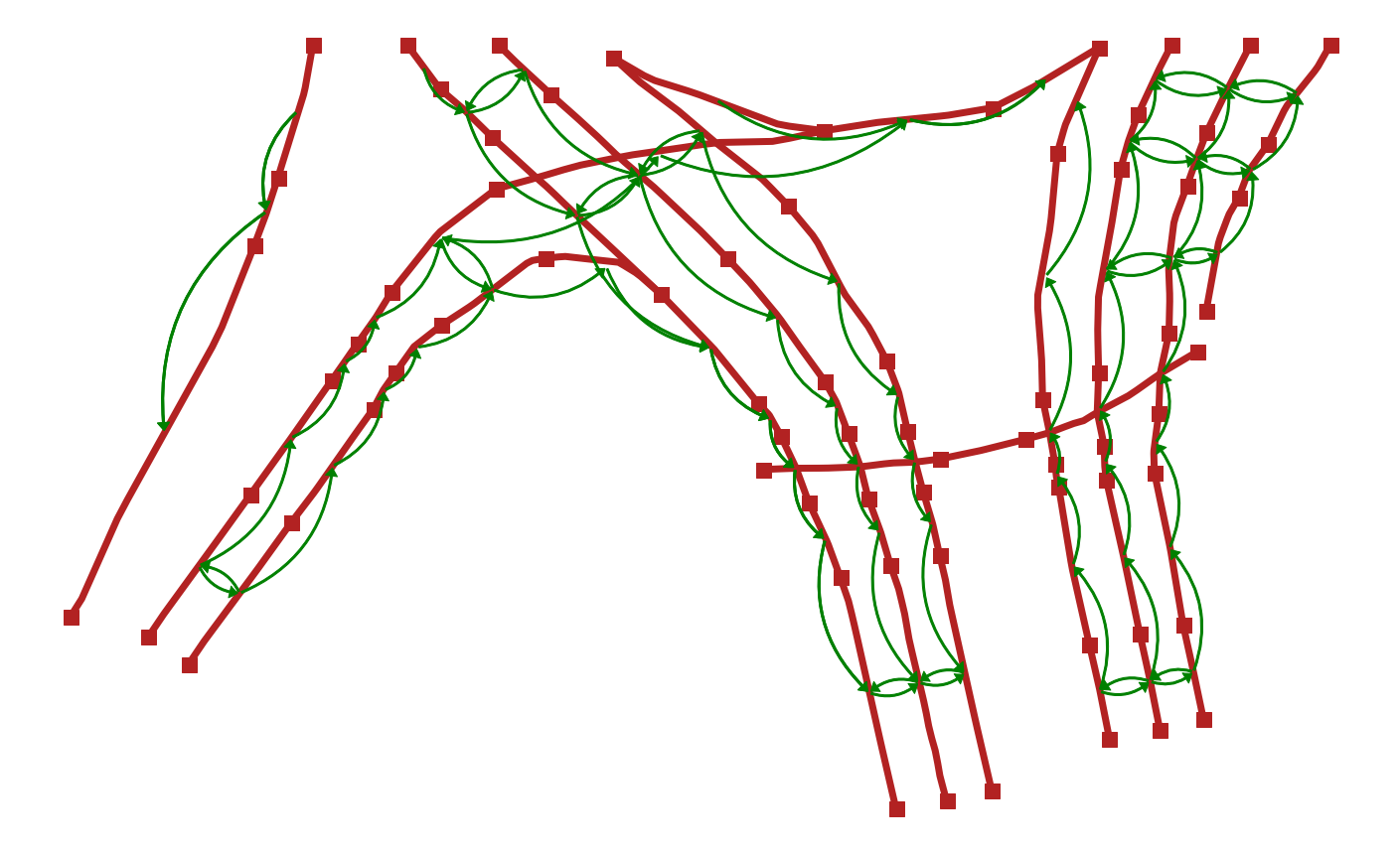
© Immel et al., 2024
Public driving and map datasets that ship with, or are expressed in, Lanelet2.
© KIT-MRT / KITScenes
KIT-MRT multimodal dataset with production-grade Lanelet2 HD maps covering tens of km² of European roads — cameras, lidar, 4D radar, and GNSS/INS.
Urban intersection drone dataset from ika / fka: more than 13,500 road users (vehicles, cyclists, pedestrians) across 10 hours at four German intersections.
Drone trajectories at three German roundabouts (ika / fka): six hours, more than 13,700 road users, plus parsing code and maps.
University-campus drone dataset from leveLXData / fka: about 1,380 vehicles and 8,600 VRUs in a shared space, with Lanelet2 and OpenDRIVE maps.
Dataset ↗Highway drone dataset at Autobahn entries and exits: 69,172 road users and more than 16 hours of highly interactive merging scenarios.
Research from our groups that builds on Lanelet2 — converters, map learning, and more.
© KIT-MRT / KITScenes
Lanelet2 is powering both the KIT in-house AD Stack as well as Autoware running on two research vehicles in weekly close-loop testdrive operations. Learn more at the KIT-MRT CITI project page.
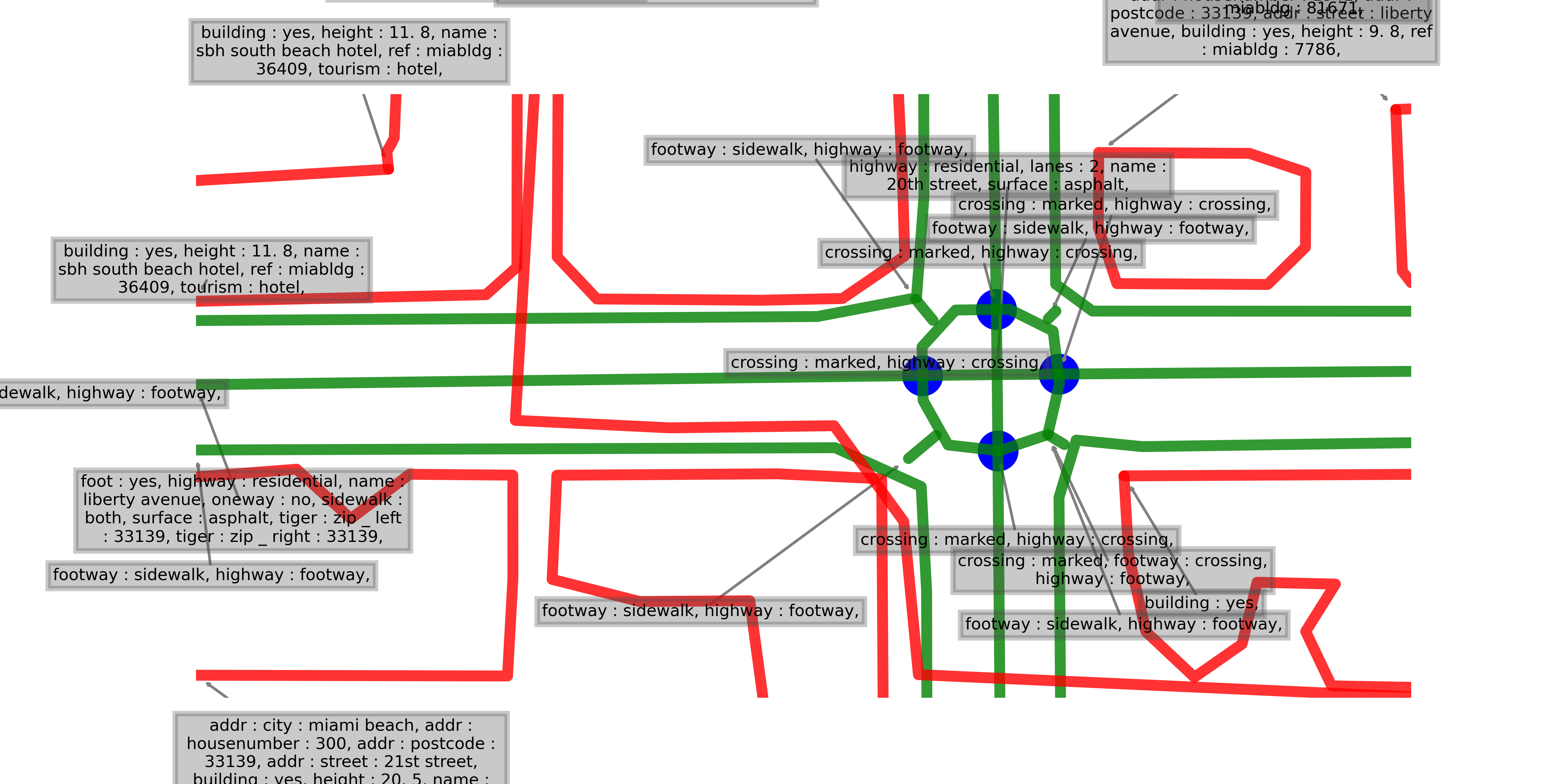
© Immel et al., NeurIPS 2025. Map © OpenStreetMap contributors
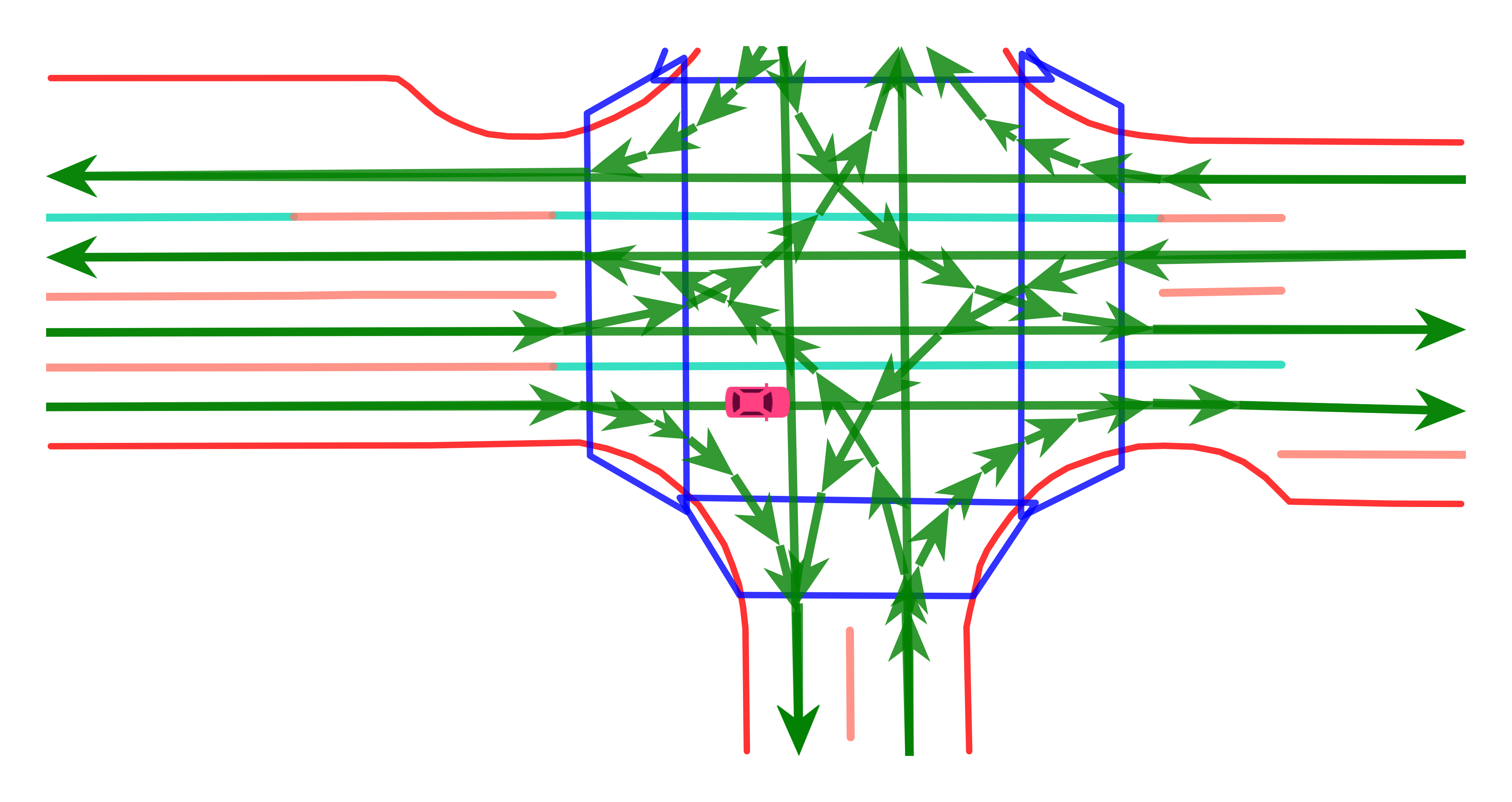
© Immel et al., IEEE RA-L 2025
Autoware extensions and mapping tools that are widely used with Lanelet2 in the stack.

© Autoware Foundation
Autoware OSM tags, MGRS / Transverse Mercator projection, traffic lights, right-of-way, and Python utilities on top of Lanelet2.
Format docs ↗Official Autoware tutorial for building Lanelet2 maps with TIER IV Vector Map Builder — also points to JOSM and MapToolbox as alternatives.
Tutorial ↗Browser-based editor for Autoware Lanelet2 maps (.osm). No local install; a TIER IV account is required.
Open tool ↗Unity plugin from Autocore for creating Autoware Lanelet2 maps from PCD — lanelets, traffic lights, stop lines, and OSM export.
GitHub ↗Open-source libraries built around Lanelet2 by the wider community.
Built a library on Lanelet2? Open an issue or a pull request on this website’s repo to get it listed.
Papers, theses, and projects that adopt Lanelet2 in robotics and autonomous driving research.
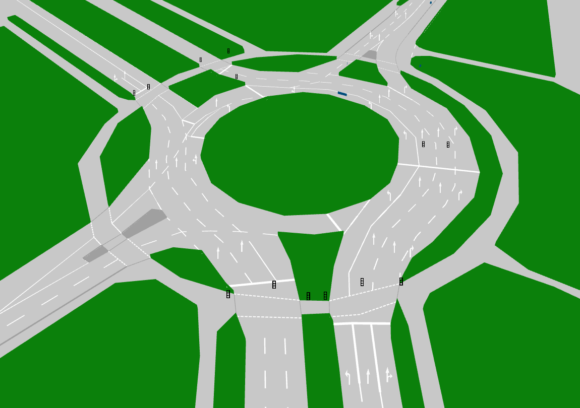
© Poggenhans et al. / FZI & KIT, 2018
Fabian Poggenhans, Dr.-Ing. dissertation, KIT (2019, CC BY-SA 4.0): methods to generate HD maps from vehicle sensors, evaluated on 102 km around Karlsruhe.
KIT library ↗Using Lanelet2 in a paper or project? Open an issue or a pull request on this website’s repo to get it listed.
Lanelet2 is ready for robotics projects and autonomous driving research — routing, perception datasets, simulation, and onboard maps. If you ship an addon, a dataset, or a paper, we want it on this hub.